Based on the 789/2021. (XII. 27.) Directive of the Hungarian government airport operators has a mandatory traffic report to CAA.The landing form below and recorded radio transmission on 122,835 Mhz Ocsény Radio is used by Multifly to crosscheck and collect all the necessary datas to comply with the above directive. Please fill out in a proper way!THANK YOU! Airport Operation


Airfield Information
Village name: Ocseny
ICAO code: LHOY
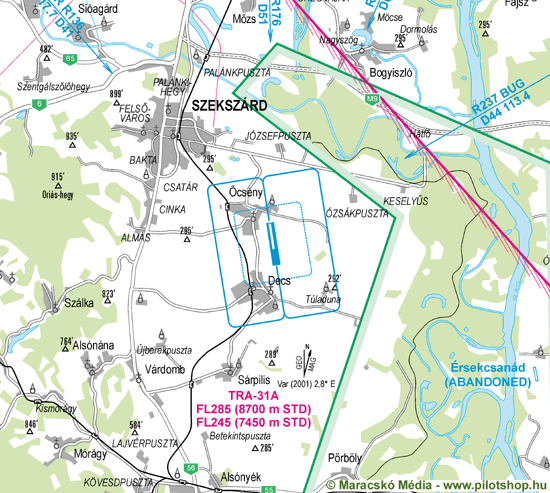
Position: 6 km / 3 nm SE Szekszárd
Geographical coordinates: N461843 – E0184550 – WGS84
Elevation: 90 m / 295 ft
Frequency: 122,835 MHz
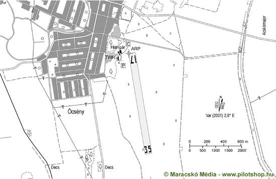
Traffic pattern: RW 35 LH, RW 17 RH
Category: Non public take-off and landing ground
Operating hours: Sunrise – Sunset
RWY: 17/35
Runway dimensions: 1260 x 150 m
Surface: Grass
TORA: 1260 x 150 m
LDA: 1260 X 150 m
Load: 22/15
For landing request please fill below form.


| Distance | ID | Name | Type | Freq | Mag Heading |
|---|---|---|---|---|---|
| 28.6 NM | PP | Pecs-Pogany | NDB | 412 | 228 |
| 35.6 NM | MOB | Taszar | TACAN | 114.20 | 276 |
| 41.4 NM | SVR | Sagvar | VOR – DME | 117.70 | 316 |
| 41.5 NM | SVR | Sagvar | NDB | 348 | 316 |
| 43.9 NM | BUG | Bugac | VOR – DME | 113.40 | 55 |
| 43.9 NM | BUG | Bugac | NDB | 430 | 55 |
| 50.9 NM | PTB | Pusztaszabolcs | VOR – DME | 117.10 | 355 |
| 50.9 NM | PTB | Pusztaszabolcs | NDB | 386 | 355 |
| 51.0 NM | OSJ | Osijek | NDB | 422 | 173 |


